Best Marine Satellite GPS Trackers for Boats and Fleets
Answering the demand for reliable, real-time location tracking at sea or on coastal fleets, these marine satellite GPS trackers provide global coverage, durable builds, and actionable insights. This guide highlights five top picks tailored for boat owners, commercial fleets, and off-grid expeditions. Each option prioritizes constant connectivity, easy installation, and practical alerts to keep assets and crews safer. Use cases range from small pleasure craft to multi-boat charters and offshore operations.
Overview of top picks for quick comparison:
- Bouncie GPS Tracker — best for integrated vehicle and fleet insights with on-device diagnostics.
- Garmin GPSMAP 79sc — best for rugged, floating marine handheld use with detailed charts.
- ACR Bivy Stick — best for global off-grid messaging and SOS with two-way communication.
- LandAirSea 54 — best for discreet, fast real-time tracking with strong battery life.
- FCBSDAW GPS Tracker — best for iPhone users and privacy-conscious locations without a monthly fee.
Bouncie GPS Tracker for Vehicles
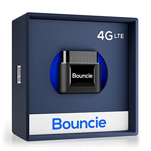
Best for: fleets needing real-time location, route history, and driving insights. This device streams up-to-the-minute positions and stores unlimited trip history, which makes it suitable for fleet managers and family use alike. It monitors speed, acceleration, idle time, and harsh braking for safety analytics, and it continuously checks engine data to flag maintenance needs. The result is proactive maintenance and safer operation across multiple vehicles.
Why selected: Strong emphasis on real-time location combined with diagnostic alerts helps prevent downtime and supports proactive vehicle management. It also offers geo-fencing and emergency-style alerts for unsafe driving patterns. A potential limitation is the need for regular data connectivity to maximize feature usefulness, especially in remote waters where network coverage may vary.
Garmin GPSMAP 79sc, Marine Handheld
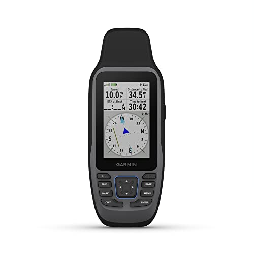
Best for: mariners needing a rugged, floating handheld with preloaded BlueChart coastal charts and multi-constellation GPS. Its water-resistant build and scratch-resistant display make it suitable for open water, day trips, and research voyages. It includes built-in compass and the capacity to store thousands of waypoints and routes, which supports coastal navigation and backup charting on the go.
Why selected: Floating design and comprehensive charting are ideal for boats that require a dependable handheld option for emergencies or backup navigation. Limitation: as a handheld device, it may not replace a full vessel GPS system for shipboard operations.
ACR Bivy Stick Satellite Communicator

Best for: off-grid vessels and crews needing global two-way messaging, GPS tracking, SOS, and location sharing. The Bivy app provides access to Iridium satellite coverage, enabling communication and updates anywhere, with optional Global Rescue emergency support. This is particularly valuable for offshore runs or uncharted routes where cellular data isn’t available.
Why selected: The combination of two-way satellite messaging and reliable SOS capabilities makes it a strong safety-centric choice for remote marine operations. Caution: plans vary by usage and may require ongoing subscription for full services, so assess anticipated messaging needs before committing.
LandAirSea 54 GPS Tracker

Best for: boat owners and fleet operators who need real-time tracking with fast updates and easy mounting. This tracker provides location updates as quick as every 3 seconds and supports Google Maps viewing through its web-based software or SilverCloud App. Its compact, magnetized design allows discreet placement on vessels or trailers with weather-resistance in mind.
Why selected: Real-time location coupled with durable magnet mounting makes it practical for marine assets that require stealthy, quick-tracking on land and water-adjacent storage. Limitation: battery life depends on movement; prolonged inactivity may reduce battery efficiency, though motion sensing helps conserve it.
GPS Tracker for Vehicles, No Monthly Fee

Best for: iPhone users seeking a subscription-free option integrated with Apple’s Find My network. This tracker uses iOS devices to provide location updates, privacy protections, and a magnetic, IP67 waterproof housing for vehicle mounting. It is ideal for individuals who want straightforward, app-based tracking without ongoing fees.
Why selected: No monthly subscription and Apple Find My integration simplify ownership for small fleets or private vehicles on the water-adjacent routes. Caution: limited to iOS compatibility and Find My integration, which may not suit Android-heavy setups or advanced fleet analytics.
OPTIMUS Wired GPS Tracker for Vehicles

Best for: vehicles and assets requiring hardwired installation with a cost-effective subscription. It provides real-time tracking with a straightforward setup and flexible monthly options, aiming at users who want reliable telemetry without complex hardware changes on the vehicle.
Why selected: A robust option for users who prioritize continuous uptime and predictable monthly costs. Caution: a monthly plan is required for full functionality, so budget accordingly for ongoing service.
Buying Guide: Marine Satellite GPS Trackers
- Coverage and connectivity: For open-water use, Iridium or satellite-based trackers ensure global coverage, while GPS+GLONASS options excel on coastal routes. Evaluate your vessel’s typical operating range before choosing a plan.
- Power and installation: Some units are battery-powered with long life, others are hardwired. Consider whether you need a magnet mount, waterproof housing, or a fixed install on a vessel’s console.
- Data and alerts: Look for real-time updates, geofencing, speed alerts, and engine diagnostics if applicable. Fleet operations benefit from route history and maintenance reminders.
- Plans and pricing: Many trackers offer tiered plans or no monthly fee options. Assess the total cost of ownership, including data rates, emergency services, and plan flexibilities (cancel anytime, etc.).
- Privacy and compatibility: Some devices integrate with iOS Find My or proprietary apps. Choose based on your preferred ecosystem, platform compatibility, and data privacy needs.
Frequently Asked Questions
- What is a marine satellite GPS tracker?
A device that uses satellite networks to provide location data and often additional telemetry for vessels, usable anywhere with satellite coverage. - Do I need a monthly plan?
Many trackers offer monthly plans for ongoing service, while some provide no-subscription or limited features with basic functionality. Evaluate how much data use you require. - What should I consider when choosing one?
Coverage, battery life, installation type, alert features, and app ecosystem are key; also consider whether you need two-way communication or only location tracking. - Can these trackers be used on boats and land vehicles?
Yes, several options are designed for multi-use, including boats, ATVs, and fleet vehicles, but verify mounting and water exposure ratings. - Are there safety features beyond tracking?
Some devices include SOS, emergency beaconing, health and maintenance alerts, and geo-fencing to improve fleet safety. - Which tracker is best for a small private boat?
For private use with strong portability and app support, options with easy mounting and no-contract plans are advantageous; consider devices that float or are water-resistant for maritime environments.